
The road from Hippo Regius (Annaba) on the Mediterranean Sea to Theveste (Tébessa) deep in the Numidian highlands was the main route through eastern Numidia. The road continued even further southeast from Theveste until it rejoined the Mediterranean at Tacape (Gabès, Tunisia), but we’ll talk about that part of the road later.
The yellow marker on the map above is Thubursicum Numidarum (modern Khemissa or Khamissa or Khmissa). Calama (Guelma) is off the road to the west, and Thagaste (Souk Ahras) is just east. Like Thagaste, which was relatively isolated in the mountains, Thuburiscum Numidarum had easier connections to other highland cities than it did to the coastal plain around Hippo Regius.
Thubursicum Numidarum is likely the city that Tacfarinas attempted to siege in 24 CE (the other possibility is Teboursouk, Tunisia). Probably of the Musulamii, who lived south around Theveste, Tacfarinas served in the auxiliary forces of the Roman army until he revolted in 17 CE with a loose confederation of other indigenous groups in Numidia. Their revolt lasted eight years. Famously, Romans called this region of Africa “the granary of Rome.” The revolt was a particular problem for Rome as it disrupted the grain supply.
Tacfarinas’ revolt grew increasingly strong until the new proconsular governor of Africa, Publius Cornelius Dolabella, stepped in and ended Tacfarinas’ siege of Thubursicum. As a result, Tacfarinas withdrew 400 km west into Mauretania near what is now Algiers, Algeria. But Dolabella found him and attacked. Tacfarinas was killed, his son taken prisoner, and the revolt crushed.
An inscription mentioning a princeps gentis Numidarum, or “leader of the Numidian people,” at Thubursicum Numidarum suggests that the city was a Numidian tribal center. However, Tacfarinas’ siege has been taken as counter-evidence against that conclusion as if all Numidians had the same political affiliations and opinions about insurrection. In any case, Thubursicum Numidarum was made a Roman municipium in 100 CE and a colonia before 270 CE. The Romans recognized it as a valuable center in the highlands.
Tourism is minimal in Algeria, which is unfortunate as there are historical and cultural gold mines all over the country. The plus for tourists who can go is that they frequently have entire ancient cities to themselves when visiting. Unlike sites in Europe, it’s not easy to take pictures with people in them if you want to get a sense of scale.
Here are some pictures of Thubursicum Numidarum. The landscape is often as stunning as the ancient remains themselves.
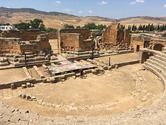
The theater is well preserved. It’s proportions are atypical, and it appears not to have been fully completed (proposed dates vary from Trajanic to Severan):
Next to the theater is a spring complex celebrating what was thought to be the source of the Bagradas River, which flows into the Mediterranean between Utica and Carthage:

A triple arch (now double) is the northern entry to the Forum Novum (“New Forum”), built between 360 and 370 CE. Behind and to the right (west) is a bath complex that was converted into a Byzantine fort:

Here’s a view of the Forum Novum from the triple arch looking south:
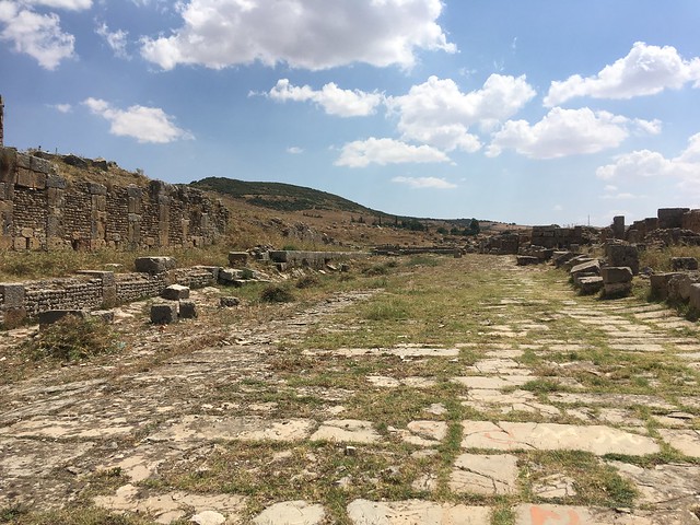
South of the Forum Novum are houses, whose walls are still well preserved:

On the hill above the theater is another Byzantine fort, constructed (like the other Byzantine forts in the region) after Africa was imperfectly conquered by Vandals, the central imperial government in Italy collapsed, and Constantinople subsequently tried to reclaim the region:
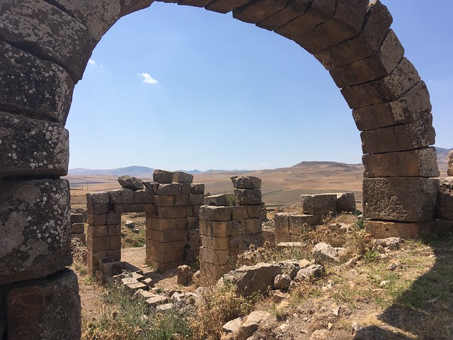
Lastly, here are the remains of a monumental arch:

There are over 150 other images of Thubursicum Numidarum in the Flickr Album. Check them out! And stay tuned for more. In the meantime, follow @transmarinae on Facebook and Twitter.
